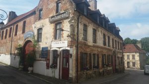
I am not sure if this is going to work, let’s see. Day four was Montreuil to Amiens and I’m just going to paste in ‘photos from the day and see if my newly installed WordPress plugin will map them. Montreuil is a lovely walled medieval town. I’d checked into what was to be one of my more upmarket hotels just to the left out of shot if you follow the road in the shot below. This gives a nice flavour of the town.
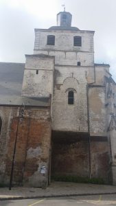
And this is the best external profile of the Abbey de St. Saulve.

And this is the worst: great, squat defensive monastic architecture but you can almost hear the building saying “you won’t use that shot in the promotional material will you, it’s not my best side”!
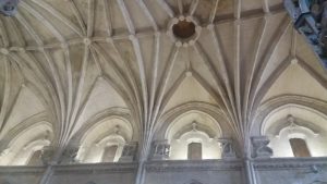
The inside is beautiful with lots of the early medieval stone carving that I love. Here’s the roof of the nave.
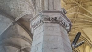
And here’s just one of the capitals. Definitely my sort of architectural art.
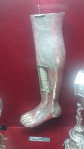
Hm, I must learn how to align ‘photos in posts. I’m not so wild about saints’ tibias in silver settings but in case you go for that sort of thing, here it is.
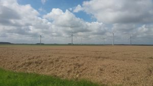
And then Toto and I were off, first across huge fields with their modern wind turbine crops as well as the evidence that they still produce more conventional harvests. There was a definite but easy cross wind on warm day that seemed just right for me and the turbines which were turning at a good steady rate.
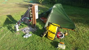
And here’s the then unnamed Toto and the Garmin which was recording the route we took. (I have no idea why I took this then):

And then I was again, as with the Great Stour, following a river slowly pulling nearer to Amiens and seeing lovely sights along the way. That started, pretty well immediately I hit the river, with this rather grand ruined house.

And then this barge. I imagine they would have been an important mode of bulk transportation well into the 20th Century.

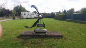
Then there was this memorial to WWII. The inscription says that it’s a propellor from a Lancaster (“ND 689 KMO”) and that it crashed on the 20th of May 1944 and “emerged”, I assume was dredged up from the river, on the 12th of September 1998. I don’t know if the implication is that the thing below is a bomb from the plane.
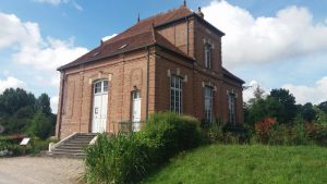
And this was the earliest hydro-electric power station I’ve ever seen. The battered sign was full of information. It started generating electricity for the neighbouring town in 1903 and supplied another one from 1912 and was only decommissioned in 1974.
And finally, quite tired by then, I made it to Amiens town campsite where the pitches had their own power and water.
And a bit later I got a lovely sunset, not well caught by this but it’ll do.

And is this the map?
[wpgmza id="1"]
Ouch. That really, really didn’t work did it?! In fact, it’s a pretty fine example of how things in WordPress can sometimes go very, very wrong. Apart from just having a rather odd looking bit of code that is supposed to generate the map, it actually all looks reasonable in the editor.
OK. I’ve got some more sleuthing to do but in the present day I must stop!